Minggu, 20 Mei 2012

Stone Walk (Death Valley National Park)


Stone Walk (Death Valley National Park)

Death Valley National Park is a wonderful place and save the unsolved mysteries of the stone walk. Stone walk is a strange phenomenon that even you would not believe if you do not see the evidence directly, but in a dry lake named Racetrak Playa, The lake is located in California, United States. Walking stones contained in the lake is as yet be explained scientifically, a very popular theory about how to move the stone is a stone was moved because of blown by the wind, this theory is the most likely theory is based on the direction of the stone trail leading from the barracks toward the northeast, it means parallel to the direction of the wind that blows in Racetrack Playa, others revealed that the stone was moved by humans or animals, but this theory is very difficult to prove because the current run to move the rock in this lake mud in a very soft so if there is a good move this stone was supposed to leave an animal or human, or at least muddy footprints around the stone will be broken and the theory goes further to say that the stone was moved because of the ice, but this theory is still difficult to prove in scientific.
Stone Walk went on a mystery because until now no one has ever seen this stone goes, if the theory of rock running because the wind is a theory that you believe you should think harder because of the stone that runs not only the stones are small but there is a stone walk which weighs hundreds of pounds. Perhaps the stone walk will always be a mystery that is worthy to be discussed until now, the rock goes this is what makes Death Valley National Park became a favorite tourist destination is beautiful, amazing and full of mysteries waiting to be solved.

Jumat, 18 Mei 2012

Stone Baalbek


Stone Baalbek
Baalbekis the name of a town situated at an altitude of 1170 m, exactly in the Beka valley of the State of Lebanon, Stone Baalbek  is a stone rubble which was once a Roman temple, Stone Baalbek also thought to be the largest Roman temple ever existed. Baalbek is also starting a very famous after the discovery of the ruins of Stone Baalbek  is very impressive. Same with the other stone buildings such as Stonehenge, the Borobudur Temple and building Coral Castle, Stone Baalbek  also save a lot of mystery that still can be solved, one of which is the way to build this temple is made up of stone weighing 1200 tons? but at that time there has been no heavy equipment that can lift objects weighing it. Baalbek's name comes from the word Ba'al is a god of the Phonecian, Ba'al is also the name of a town is located about 86 km from the capital city of Lebanon. 

At Baalbek is an ancient city inhabited by people Phonenician, but in about the year 323-64 BC when the Greeks began to enter and occupy the city of Baalbek, the Greeks change the name of the city became "Heliopolis", or when defined by the City of the Sun, at this time anyway that is, when the Greeks led by Julius Caesar or Julia Augusta Felix Heliopolitana colonia built many magnificent temples with stones that are very large, Julius Caesar built the Temple dedicated to the god Jupiter who is the god of the ancient Greeks. The temple building was built with stones so neatly with the size is very impressive and when using equipment today can not be used to lift the stones. To the south of Baalbek Stone also found a former quarrying and stone cutting place and there are also pieces of rock that the suspect was processed stones the largest ever built by man, the weight of the stone is even expected to reach more than about 1,500 tons.

Selasa, 15 Mei 2012

Alexandria (Cleopatra's Palace)


Alexandria (Cleopatra's Palace)


Alexandriais a building that is believed to be Queen Cleopatra Palace is very popular, although still in the research phase of the truth of these findings, but on Tuesday, May 25, 2010 a team of scientists discovered the ruins of several buildings on the island under the sea near the city of Alexandria Anthirodos , Egypt. This discovery is an important discovery, and they believe that this discovery is a complex of Isis Temple and the Palace. 


About 1,600 years ago the experts predicted on Earth have occurred that resulted in Earthquake Tsunami, Natural Disasters is what causes the Alexandria sank to the seabed. Underwater archaeological sites of the richest in the world and continues to look at carefully by scientists, they were diving around the city of Alexandria to find the ruins of Cleopatra's palace, with a very hard effort they finally managed to find Cleopatra heritage artefacts, some relics of the found was a stone-shaped head with a large size, the scientists suspect that this is a picture of the son of Cleopatra and her lover before Antony, Julius Caesar, sphinx statue is also found among the ruins of this building, sphinx statue is probably the father of Cleopatra, besides that, the scientists also found some major points in the life of Cleopatra and Anthony couples, they also found a place Anthony retreated in shame after the defeat of Octavian, the building was named in Timonium.

Sabtu, 12 Mei 2012

Coral Castles


Coral Castles
Castle Coral is a very beautiful building, majestic and stunning, the building is located in Homestead, Florida. Beginning of the establishment of this building is when Edward Leedskalnin who was then aged 25 years and was engaged to a 16-year-old girl was shocked when one day before his wedding 16-year-old girl who is canceling their wedding, because he felt heartbroken Edward then decided to stay in America, he spent about 30 years to build this amazing castle. The building is said to be amazing because it is built of stone containing coral and oolite shells fossils and weigh up to several tons, the Castle is very unique and mysterious because it was built by one person is Edward Leedskalnin was born in a small country in Europe: State of Latvia, is that we think the use of logic there can be no one who could unite the rocks by the ton weight without heavy equipment but Edward Leedskalnin said that he had discovered the theory of how the ancient Egyptians, people Asia and Peru people could lift a stone weighing several tons have no heavy equipment. Prior to actually stand in Homestead Castle coral've built a new city in Florida in 1936 moved to the well-known locations in Homestead as it is now time to move Castle according to reports circulating that took three years and did not stop there but Edward continued to build the castle until her death in 1951. Many people assume that this building is the best rock structure ever built in the 20th century and many people equate with Stonehenge. 


Total area of ​​coral castle is about 4 acres consisting of 1000 tons of rocks that form the walls, towers, carvings and even furniture, to keep them together Edward utilize only heavy rock stacked and do not use any adhesive that is This is surprising from the building when the Florida city was destroyed by hurricane Andrew with the most deadly category is Category 5 buildings are not damaged even rock there is no shift. Edward himself lived in the two-story tower has a height of 2.4 meters located in the area of ​​the coral Castle, Edward residential tower is decorated with obelisks, fountains, ponds, statues of astronomical objects up to an telescope made. In addition to building the most amazing towers next is a door that has a weight of 8.2 tonnes which has great balance so that a child could easily open the door, unfortunately with no known cause in 1986, this door can not be in motion as before.

Jumat, 11 Mei 2012

Pyramid under Sea of ​​Japan


Pyramid under Sea of ​​Japan
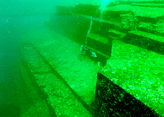
When you hear the word pyramid you will certainly imagine a building that was in Egypt, but it turns out Japanese submarine in the area there is a ruined building believed to be a pyramid of the highlights of this building is the fact that this building had nothing to do with Japanese language support used today, this raises a big question is when this building was built,,? Is the pre-history?. This civilization has nothing to do with the current Japanese civilization. Jiujing Shengjun Japanese nationals are people who find a certain relationship between Japan by the Greek nation in ancient times, in recent years under the sea coast of Japan have been found many relics of ancient civilizations. Since March 1995, divers found 8 places relics scattered around the island of Yonaguni Hiroshima to the ocean. actually in the State of Japan are also many pyramids are found scattered in small or large number of stone buildings and even the giant is also found here, the Japanese submarine was found a rectangular building, but because it was covered by a reef so the building is not seen with clear and not yet certain whether manmade or natural phenomena, then re-discovered a giant spiky terrace below sea level southern Oklahoma, in contrast to previous findings confirmed the results of these buildings man-made foam. In the next few Japanese archaeologists rediscovered a pyramid-shaped building construction is very large under the sea with a depth of 100 feet. When viewed from the shape of the building is likely to come from 8000 years BC and was in a large region that is equipped with two doors on each side then it might be this building is the location of a particular ceremony, with the discovery of this building Japanese archaeologists argue that the only civilization Japanese nation at the present time from the stone age, while not possible if the beginning of civilization in Japan are in the stone age because in those days there was no equipment that could be used to construct the building construction as grand as this, the Japanese civilization today are not you do with the building underwater pyramid that are here, if that opinion is correct, then in the ancient times in Japan there is an unknown civilization, and they are very advanced.


Some facts that can prove that the building is the result of human civilization is a few piles of small stones that are in the vicinity of the pyramid-shaped mini formed from paving stone shaped like a ladder that incorporates the main building, an expert named Professor Kimura says that this building might serves as a shrine to the god, his opinion was based on the belief population of Hiroshima who believed in a god who brought the welfare of the sea-god Nirai Kanai.

Rabu, 09 Mei 2012

Lake Michigan Stonehenge


Lake Michigan Stonehenge
Travel places Stonehenge, located in the UK you may already know from the first and perhaps you have visited, have not finished talking about how to make the Stonehenge located in England we had another surprise in the report of a professor named Mark Holley on a similar building of Stonehenge located 40 feet below the surface of Lake Michigan, Mark Holley is an underwater archaeological professor at Northwestern Michigan University College claims to have found a stone structure at the bottom of lake Michigan that some of them arranged in a circle like Stonehenge and one of the stone has a carving of a mastodon , if the original carving the engraving is estimated to have 10,000 years of age or according to the presence of mastodon. This startling news began when Prof.Holley and fellow named Brian Abbott was put on a ship equipped with sonar equipment that aims to examine some of the shipwrecks in Lake Michigan Then they found a pretty strange rock formations, among the rocks there having engraving as mastodons, however, but Prof. Holley could not confirm it's really carving mastodon or not. Michigan has previously had petroglyph sites and standing stones even as Stonehenge. However a representative from the University of Michigan Museum of Paleontology expressed the opinion that that even though he was skeptical, but he was still interested to learn more and he also hopes to see the photos better than the arrangement of the stones. So we have to wait longer if Stonehenge mystery under the surface of Lake Michigan water will be solved and the United States waiting to be discovered at once would be an extraordinary discovery.

Minggu, 06 Mei 2012

Monumental Instructions for the Post-Apocalypse


Monumental Instructions for the Post-Apocalypse
Monumental Instructions for the Post-Apocalypse, or better known as Guidestone Georgia is building a very strange and mysterious, as yet there are people who express purpose of the awakening of this monument, this building is located in northeast Georgia, although this is not like a monument monument More mysterious is built in prehistoric times but still bears a difficult mystery to solve, the building has a height of 16 feet and weighing 20 tons is composed of granite pillars, rectangular towering upwards. The building was founded by a group Mansonic, Freemasons, Illuminati, the pagans and the supporters of other satanic groups. This fact is reinforced by the symbol of their classes on the flat top of the highest in the field. Maybe they think that as if all and all cultures in the world came from, subject and started from a single source, namely those groups who want to establish a New World Order (NWO). This fact can also be a bit to prove that it's possible they intend to teach classes of these schools, and will continue in subsequent human culture. It's strange all the things associated with this monument even more unusual because it is not known who built this monument even though there is one person who knows who built this monument, but he did not want to tell it. One strange thing in this monument is a sculpture on the languages ​​of the great cultures such as the hieroglyphic language of Chinese, Arabic, English, Russian, Indian, Hebrew, Spanish and Swahili, in addition to the four sides of the new granite lying above, there are instructions that use the "language of the old culture" that has vanished from the earth's languages ​​are: Sanskrit language (Sanskrit), Ancient Greek (Classical Greek) and Babylonian Cuneiform and Ancient Egypt (symbolic) or Egyptian hieroglyphs. Carvings are estimated to contain instructions to the men who survived the catastrophe can rebuild a new civilization on Earth and in command as well so that people do not forget the history of the ancestors, another oddity is above the granite pillars that are rectangular shaped book and in the midst of the four pillars there is one more pillar Commandment written on the walls. This monument is actually a nickname as the Day of Resurrection monument remains unclear, whether the writings on the stones is associated with a prophecy about Judgment Day is also unclear.

Jumat, 04 Mei 2012

Waitomo Glowworm caves


Waitomo Glowworm caves

Waitomo Glowworm Caves is a very unique and required for your visit. Cave is located on the northern island state of New Zealand is becoming very popular because there are thousands of worms "lgow in the dark" stuck to the ceiling, the worms will be putting out the light that makes you feel like in space, a cave in the region this does have a unique, one of the most beautiful and unique is Witomo Glowworm caves because it has a unique source of natural light and can be enjoyed at any time by tourists visiting the cave is not like most dark cave or receive light from a source intentionally posted. 
Waitomo Glowworm is acing daric habitat glow in the dark or in Latin is called Arachnocampa in this cave there are thousands of worms glow in the dark that adorn the ceiling of the cave and emits green light is very beautiful especially the actual condition of the dark cave to give the impression would like to be on another planet, this place is at once a daric acing the largest habitat.

 Tracing the cave using inflatable boats will be an unforgettable experience say, this is what you can try when in the sights including the type of this watery cave, this attraction offers a tour using inflatable boats that you can follow, so you get an explanation of the historical and geographic explanation of the cave once more about the worm glow in the dark I suggest you use a tour guide to explore this cave, if you are not happy to see glowworn from afar you can visit the cave Ruakuri, if you want to enter this cave then you have to go through the steps of spiral-shaped and very impressive on arrival at the cave you can see the worms Ruakuri unique up close you can even hold her.

Kamis, 03 Mei 2012

Old City Valletta


Old City Valletta
If you love to visit places of historical sights then it's not complete if you have not visited the Old City of Valletta, the capital of the State Valleta Malta. Small, prosperous country in the Mediterranean Sea, the State is only a population of 400.000 inhabitants. Malta countries rely on tourism as a source of revenue this country, one of the flagship attractions in Malta is Valletta's Old town, in this country almost every day there are cruise ships that dock here thousands of tourists who boarded a cruise ship is certainly very keen to enjoy the city surrounded by a fortress which was built in around the 16th century, Valletta is a city that is historic and unique. Valletta's name comes from the name of the hero who fought to defend Malta when war opposite the Turk and Rhodes, the fighter named Jean Parisot Valete. Most visitors are interested in this city because almost all of the building is yellowish gray, this color actually comes from a rock into the main building material of this city, even the walls that surround the city is also built of coral stone. To maintain the uniqueness and history of the city is still using the Maltese era architecture is very thick with the influence of the triumph to Christianity. Spiritual life of the people of that era could be said to be so high it can be seen from the church and cathedral buildings are high and associated with the splendor of the divine. In addition to building the architecture of Malta time here you will also see a building with modern architecture on the edge of the dock, the building is a café, restaurant and souvenir shops that provide extra services to visitors, for the added convenience of this building is also equipped with free Wi-fi .

Rabu, 02 Mei 2012

Havelock Island

Havelock Island
The island has beautiful beaches that are located in the State of India, Havelock is one of the favorite tourist destinations in India end of the country, this resort offers a beach with beautiful white sand, clean and comfortable, the beach is even becoming a tourist destination for about 10 thousand people every year, along the west coast you will find havelock this two-kilometer coastline with no footprints. Radhanagar beach is known by some tourists as one of ten hidden beaches that have amazing beauty, this beach is hidden behind an overgrown rain forest of palm trees. Activities you can do while in the tourist area is diving off the coast of Radhanagar even there until 15 at which point dive in the dive spots you will find fish lionfish and Napoleon fish, you will also be mesmerized by the colorful coral reefs Colorful, beautiful coral reefs and even these you might have encountered a few meters from the beach. 


At sunrise you can see the deer that roam along the beach, you can also rent a kayak to get through the mangrove forest, if you have the courage you can also look for lizards and crocodiles in the mangrove debt, if you want to see the animals and species endemic to the island This you can trek to the canopy. If you want to stay in this place the best place to stay is the Barefoot Havelock, resot this form of traditional houses built of bamboo and palm trees, the reasons to use bamboo and palm trees as building materials are to be more environmentally friendly. A good time to visit this island is between December and March, this month you can see the turtles hatch, while in the month of May to October or during the monsoon dating rajan angina (pet elephant 58 years old) and you will not dive can not take pictures under water with Rajan.


Selasa, 01 Mei 2012

Landaa Giraavaru beach


Landaa Giraavaru beach
Maldives is a very beautiful place, one of the beauty of it is Landaa Giraavaru beach, you can reach this place by using the air line by using a small plane from the International airport which takes about 45 minutes to arrive at this beach, I think the beach This is the most romantic beaches of the islands are coral reefs in the Maldives, Landaa Giraavaru is a romantic place because of the shape and color of the sand that can be changed from sunrise to sunset, the sand on the island of 18 hectares of this can be colorful because the influence of clownfish and oriental Sweetlips. The only accommodation if you want to stay in this exotic island is at the Four Seasons Resort Maldives Landaa Giraavaru, although this is the only accommodation on the island but it has excellent facilities, here you can enjoy a massage spa located at the bottom marine fish passing while looking around you, the food offered in this place is also very diverse as chicken and cinnamon couscous, chickpeas and raisins, and various Middle Eastern food is very tasty. While on vacation in this beach you can join a tour off the coast, they have a duty to observe the development of more than 200 projects that will expand the coral reef lagoon of the island, specially for those of you who have hobbies are snorkeling on the beach you can see various kinds of marine animals amazing as the butterfly fish, unicorn fish and white tail, manta and sharks, but if you want to dive with sharks or stingrays eye wear oxygen tanks. The time is right for you who want to see the underwater life in the tourist area is in December through April at this bull state of sea water is very clear so you can see clearly, and in July through November of this month you can see Manta and sharks in large numbers.

Minggu, 29 April 2012

Niagara Falls


Niagara Falls
Niagara Falls is a very exotic and fabulous, this waterfall is located on the border between the United States is the State of New York with the Canadian province of Ontario. This waterfall is about 17 miles (27 km) north west of Buffalo, New York and 75 miles (120 km) southeast of Toronto, Ontario. The name "Niagara" is derived from Indian languages, namely "Onguiaahra" which has meaning Strait and other word is "Ongniaahra" which means it is the roar of the water, before the waterfall is named Niagara, before the public about calling it "Niagagarega". Niagara Falls was formed about 18,000 years ago, when the ice cubes in the southern part of Ontario that are 2-3 km thick, has started to melt and flooding of Lake Erie and then melt the ice is flowing through the Niagara River meets Lake Ontario and that then flows into the sea via rivers St. Lauwrence, Niagara peninsula free of the ice sheet about 12,000 years ago. When the ice melts to form the Niagara River flows, and river erosion and form the Niagara Falls. Niagara is the name of a group of three waterfalls. The third waterfall is a waterfall Horseshoe (sometimes commonly referred to as Canada's waterfall), waterfall America, and the smaller Bridal Veil waterfalls that are separated by an island called Luna Island from the main waterfall. This waterfall can be split into three parts as in the upper Niagara River flowing from Lake Erie as far as 35 km, split by the "goat island", thus forming three waterfalls. Later the water that falls to a very heavy hit the rocks below the rate of 40 km to 100 km per hour, thus forming a water depth of up to 52 m below the surface of the river. After water poured into the bottom of the Niagara River, then the river turned to the right (90 degrees) and flows along the 23 miles to the lake Ontario, Canada. Niagara is the widest waterfall in the world to-5 after the Waterfall Country Guiara in Paraguay, and Celilo Falls in Oregon United States, Kettle Falls on the Columbia River and the United States is the most wide Victoria Falls in Zambia and Zimbabwe, Africa south. Although not the highest waterfall or waterfall is the widest waterfall is very famous and spectacular with a volume of 2.271 million liters of water per second, the water flowing from the waterfall is a source of drinking water for approximately one million people in Canada and the United States, when you visit this tourist area you can do many things of which you can fish, swim or canoe and of course trying to play seen rainbows that often appear in this waterfall.

Sabtu, 28 April 2012

Victoria Falls (widest waterfall in the world)


Victoria Falls
Victoria Falls is a very impressive waterfall, this waterfall is located in the State Zimbabwa and Zambia as well as the boundary between the two countries, the waterfall is derived from the Zambezi river. Victoria Falls was first discovered by an explorer from Scotland named David Livingstone, he discovered the Victoria falls in 1855 while visiting this lake, Victoria's name comes from the name of a famous queen who is Queen Victoria, but in fact this waterfall has a real name the Mosi-ao-Tunya which has the meaning "thundering smoke, because the State is owned by two waterfalls are also two national parks in the protection of the National Park Mosi-oa-Tunya in the State of Zambia and Victoria Falls National Park in the State of Zimbabwe. Victoria Waterfall is a spectacular waterfall and a favorite tourist attraction in South Africa, this waterfall has a height of 108 meters to 1708 meters wide reach of this size have a degree victoria waterfall as the widest waterfall in the world and become one of the world heritage site by UNESCO, this resort is very popular during the British colonial rule Northern Rhodesia (Zambia) and Southern Rhodesia (Zimbabwe), visitors to these attractions, especially in parts of Zimbabwe had declined dramatically during the war between Zimbabwe and Rhodesia. Two National Park which protects the waterfall is quite small, the National Park Mosi-oa-Tunya's area 66 square kilometers while the Victorian National Parks fall has a more narrow area that is only 23 square kilometers. Most visitors visit these sights of Victoria Falls (Zimbabwe) and maramba (Zambia), where tourist facilities are complete. Each city is accessible by road using the train, and could also be through the air. One of the relics of prehistoric times in this location was the discovery of Homo habilis stone artefacts of hominin, according to the researchers of this heritage shows that the likelihood of this place has been inhabited since the two million years ago with more advanced equipment in the middle of the stone age, there are two options the exact time when you want to visit this place is in February and March when the river was overflowing so that as many as 540 million cubic meters per minute waterfall and you will see a waterfall that mixes with rain water that is spectacular or in November, when water is at a low point, and you can see the Victoria falls like a curtain that divided into smaller channels, you are free to choose for the scene when the two are equally beautiful, unfortunately, now the beauty victoria fall from a little disturbed because of the many resort and hotel buildings there is even a dam that could threaten the park around the falls victoria if the dam is overflowing.

Jumat, 27 April 2012

Angkor Wat (Cambodia)


Angkor Wat (Cambodia)
Agkor wat is an attraction in the form of Candia, or the Temple which is located in the city of Siem Reap on the plain of Angkor in the country called Cambodia, tourism area, it has been recognized as a UNESCO world heritage sites. Suitable for you lovers of historical attractions. In the plains there is a lot Angkor temples or temple buildings are very beautiful and wonderful, one of which is Angkor Wat temple which I think is the most beautiful and most famous of the other temples here, this attraction is a very popular attraction Cambodia is well known even in the World. Angkor Wat was built in the mid-12th century during the reign of King Suryavarman II, experts predict the development of Angkor Wat takes about 30 years. Hindu doctrine of the era is evolving so many people who embrace the teachings of Hinduism, the State of Cambodia who embraced Hinduism considers Mount Meru as the center of the World as well as a special place chosen as a place of Hindu Gods and Goddess, in the State of Cambodia as well as many found in folklore that tells of Mount Meru, the towers of Angkor Wat is a beautiful tower and main tower is also in the building of the temple or temples of Angkor, the area surrounding Angkor temple there is a lot of the canal wall and the wall in the Cambodian community trust representing ocean and the mountains that surround the world, the entrance to this area is a bridge that is named Barays, upon entering this place you will also be brought into a rainbow bridge that according to public confidence in the bridge connecting the real world with the gods of nature. Angkor Wat is a wonderful place, therefore if you're visiting in the State of Cambodia then it must visit this place, to enter these attractions you need to buy a ticket at a price that varied depending on how long you in this area, the ticket price of U.S. $ 20 for one day, tickets priced at U.S. $ 40 for three days or U.S. $ 60 for tickets for seven days. Because of the beauty of this place is so common that the holidays you have to queue to buy tickets, but if you do not like to wait in line then you can buy tickets in the afternoon, do not worry about not be able to enjoy the beauty of this place because the time to visit this place the evening because you can enjoy the view at sunset is very beautiful and you can also enjoy a tour the next day, when the Angkor Wat take your time to have dinner at the FCC Angkor, because here are authentic Cambodian food and International food, the atmosphere at the FCC Angkor is very comfortable with pretty shade trees in front of the restaurant and to enjoy a meal here you only have to pay about U.S. $ 30 for two people.

Kamis, 26 April 2012

Glass Beach California


Glass Beach California
California, is an area that has a variety of exciting attractions to visit, when some time ago I've written a green sand beach in Hawaii so now I will review on a sandy beach glass that was in California, the beach is very unique This was in MacKerricher National Park, near the City of Fort Bragg, California. sand glass sand may be very strange if not impossible, there is a beach with sand glass, but it is the truth. Glass Beach is a beach with sand glass, along the shore are scattered a lot of rocks glass, but the beach is not just there with a beautiful sand glass with various colors, glass sand beach is formed channeled through a very long process and even the beach was once dubbed "The Dumps" due to a landfill by the local community, at about the 20th century it was de-grade the beach into a landfill by the local community, various types of waste disposed at the beach once this starts from household appliances, cars were bottled up been thrown into this place, even if the garbage has piled up here on the beach there is the burning of garbage, but to reduce the waste that is piled in 1967 the government began to close around this place at once begin to be repaired and cleaned, after several years through the natural process of broken bottles and glass on the beach is transformed into a beautiful stone, when in this place you do not have to worry your feet hit rock splinters of glass because the glass rocks here are flat and smooth. Glass Beach is very interesting to visit the tourists, many of the tourists who visit these shores, most of them visited the beach as curious about this unique natural phenomenon, the first visitors to the beach is free to take a sand glass to take home, but after this beach under the auspices of the National Park MacKerricher the sand should not be taken home by visitors freely because it is in the protection of the park. Although there are rules that prohibit bringing home the sand of this beach, but some visitors are still determined to bring home a beach or a few pieces of stone as a memento

Rabu, 25 April 2012

Linow Lake


Linow Lake
Linow lake is a very unique lake in the City of Minahasa, North Sulawesi Province State of Indonesia. If when you visit the lake you'll find a lake that has a blue colored water or lakes with clear water then you will not find anything like that when visiting the lake Linow. Linow lake has an area of ​​approximately 34 acres with a color that can change naturally without the aid of light, If you from the airport Sam Ratunlangi and have a desire to visit this lake, then you can go straight to Tomohon, North Sulawesi Province, Indonesia with distance of about 37.6 km and can be taken for 40 minutes using a motor vehicle. Of Tomohon, the journey can continue to travel as far as location approximately 700 meters. If you ask how can the water of this lake is subject to change.? So the answer is the color of the water in Lake Linow is subject to change by itself because this lake contains very high levels of sulfur, therefore the lake is visited by tourists especially when entering the holiday, the visitors could be multiplied, most visitors choose this lake becomes their destination because of curious about the lake that has water that can be changed it is no wonder if the lake has become a mainstay attraction of North Sulawesi province, Indonesia. Linow lake you can relax and look at the beauty of this lake in an area that is structured like a wooden pier, not only has water that is subject to change, but the lake also has an endemic species of grouse and thousands of insects that are named sayok or commodities by local people, to be able to enter this site you must buy a ticket at a price of Rp 25,000, - but you do not just get a ticket, at a price of Rp 25,000 you also get a cup of coffee or tea and coconut cake, is certainly a fair price for the beauty of the lake and a drink as well as food, when you visit this lake you should be a little careful because around this lake there are pools of hot mud.

Selasa, 24 April 2012

Bowling Ball beach


Bowling Ball beach
BowlingBall beach, better known by the name of Schooner Gulch State Beach is a beach that is very unique because the beach there are many stones that resemble bowling ball, the beach is located in the city of Mendocino, California, USA,or is about 4.2 km of protected areas Conservation Area and Point. California is a dream destination for many. California is a must-visit place when you visit the United States, not only because of Hollywood glamor, but also because there is a phenomenon unique beach and saying to miss. The unique thing is at once strange stones resembling a bowling ball having a diameter of one to two meters is highly formalized as one set, but all of these stones was a purely natural phenomenon. Geologically, the coastal rocks is called concrete technical. These stones mudstone from the past, namely during the Cenozoic. Over millions of years, the waves of the shore of the Pacific Ocean was formed by these stones up like a bowling ball. The uniqueness that is the main attraction for tourists to visit this beach. This beach is the only beach in the world who have this phenomenon, particularly prominent among other California beaches with white sand. The best time to visit this beach is during the summer, when sea water was receding at the time the stone that resembles a bowling ball will be dry, so when you can play it on a rock and watched the sea, in addition you can also play in the rocks are beautiful and amazing, but because of this unique beach bowling ball very often visited even though it was winter and the weather was not so good. While visiting this beach you can picnic on the rocks watching the waves are unique, the experience of a picnic in a unique place that you will never forget, apart from that surfing is also a favorite activity of tourists who visit the beach, once you feel tired then it's time to see beautiful sunset from the rocks like a bowling ball.

Minggu, 22 April 2012

Easter Island


Easter Island
EasterIsland is part of the Rapa Nui National Park, Easter Island is located in the State precisely in the province of Valparaiso Chile or southern Pacific Ocean, Easter Island in Polynesia called Rapa Nui, whereas in Spanish is called la de Pascua. Although the island is named Easter, but it really has nothing to do with the tradition of the Christian Easter. Easter Island's name is not actually the original name of this mysterious island, is actually on a day when Europeans set foot on this island and at the time when the celebration of Easter coincided approximately the week of Passover in 1722, when they get around the island they were surprised when find a relic of history seem implausible because in such a small island with no access to transport, without any population there are many statues scattered shaped the human face. "MAOI" is a sculpture that is widely available on the island and made the island famous, at least about 600 MAOI spread across the island. MAOIs have a height of about 9 meters and weigh thousands of pounds in the estimate. MAOI is a statue carved from stone, most of the manifold monolithic statue or carved from a single stone, even so here also there is a separate additional statues, carved from an MAOI Most vukanik soft coral found in the Rano Raraku. Although most of the MAOI here a statue of a human head or face, but here too much MAOI which has shoulders, arms and torso that have been buried for years, until now still no meaning MAOI but anyone who knows the meaning of the MAOI is called " guard the island ", so called because MAOIs are believed to represent the spirits of ancestors or as grave markers or perhaps the leading figure, to the present theory does not yet exist that could explain how the original inhabitants of this island to remove the statues are very heavy and on the move to the corners of the island , the story of this island population of the island ended tragically, according to reports circulating, purportedly on a day of food on the island began to thin out the population began to cannibalism, not only that, the nation's invasion of Peru and Bolivia to the natives of Easter Island eventually disappeared from the island them. Besides MAOI There are also Easter Island Petroglyphs are images carved in stone. About 1,000 sites with more than 4,000 Petroglyphs a catalog, designs and images are carved out of stone used to create totems, to mark territory or in use to capture an event. Easter Island also save a few stones that have called Rongorongo mysterious inscriptions and writings in this still can not solve until now.

Sabtu, 21 April 2012

Green Sand Beach (Papakolea Beach)


Green Sand Beach (Papakolea Beach)
Papakoleabeach is a beach located in Hawaii, the beach is located in the Ka'u district. This beach is a beach that is very special and unique, if when you visit a beach you will find a beach with white sand or black then you will see the beach with green sand beach while visiting Papakolea. It's not easy to reach location of this beach because it was surrounded by rocks, to reach the beach you have to climb the rocks first, therefore you are advised to wear suitable footwear used for rock climbing, rock climbing is you do not have to worry because the type of rock slip around this beach is an easy dry rock climbing. When you successfully climb the rocks so the tiredness will go away when you see such a beautiful beach, this beach has sand-colored green and be more green when exposed to ocean waves, it's beautiful scenery, when it collided with a crystal clear ocean water sand-colored green, this scene will make you feel at home looking at this beach. Expected since 49,000 years ago when a volcano exploded and spewed sand that has a unique green color, green color comes from rock fragments called Olivine crystals in the mountain. Green sand is actually derived from a mixture of ash, lava and debris from Olivine crystals. Because color is beautiful, the people of Hawaii said that Crystal Olivine is a "diamond Hawaii". Papakolea beach is a very beautiful beach with its unique green sand grains, although the sand did not originate from the crystal Olivene but its beauty can still be the mainstay and attraction to the surrounding community pride. For those of you who love traveling to the beach is unique then you should not miss, especially if you are on the islands of Hawaii is required to visit this place and bring a bit of sand to take home as a souvenir, beach Papakolea Unfortunately this not always have the green sand because the expected content of Olivine crystals in the sand of this beach will fade over time.

Jumat, 20 April 2012

Acropolis

Acropolis

Acropolisis a collection of some of the ruins of ancient buildings that used to be a small temple at the center of Athens history, this area is a plateau with a height of 156 m. Acropolis in the estimate up since the year began in 1300 BC, but this city was destroyed by the Persian empire in 480 BC, but the city is re-built around the year 467 until 404 BC, the city was built back in time to beat Greece Persia. Athens can not be separated with the Acropolis, the building is now a major tourist destination of Athens, the ancient Acropolis has a statue of goddess Athena as high as 12 meters from the gold and ivory statue is in place it in a temple that has the name of the Parthenon. In addition to the Parthenon Temple on the hillside of the Acropolis there are also the old town of Plaka, which until now there are relics of ancient buildings are still sturdy, the building is in the estimate has been inhabited and developed with buildings dating back thousands of years ago. In ancient times the city is already equipped with a named port of Piraeus is the largest port in Greece at that time. Athena does indeed have a lot of old buildings that have a high historical value, on the island of Egina there is one ancient building in the form of the name Aphina Temple, the temple has 23 pillars is still standing strong, this temple was built in 5th century BC, this temple is a place Aphaia Goddess worship. Acropolis became so popular as a tourist attraction because of its simplicity to the reach from all directions. The main attraction of the Acropolis is the Parthenon temple that is located right in the middle of this hill. Parthenon is a temple of the Greek god Athena is regarded as the patron deity of the people of Athens. The temple is expected to be built at about the fifth century BC, and it took over twenty five years until the building was completed in the wake. The building is the oldest building of all the ancient buildings in Greece. Parthenon is the symbol of ancient Greek democracy and is the world's largest historical monument. Therefore, the Greek Ministry of Culture is doing restoration to preserve historic sites are very popular and is visited by thousands of people every day. When you visit this place you'll see the magic of an extraordinary building, but the reason to preserve this building, the Greek government put protective wire actually interfere with the view, the building has no roof because according to the archaeologists in the ancient roof of the building is made of wood or materials that are easily weathered, so do not hold up to hundreds of years, although there are some old buildings that have roofs, but the buildings are designed with a stone roof.

Kamis, 19 April 2012

Colosseum (Rome Italy)


Colosseum (Rome Italy)
Colosseum or the "Flavian Amphitheatre" is a heritage building in the form of a huge building is very impressive show. This building has High 48 M, with a length of 188 M and 156 M Width, Overall Building Area The Colosseum is about 2.5 ha. The building is located in the city of Rome, the capital city of Italy.According to some archaeologists who have examined this building, Clolosseum was built around 70 AD in the ancient times when the reign of Vespasian and finally completed in the year 82 AD built in the reign of Titus, the son of the King of Vespasian. Derived from the Colosseum own name Name of a giant statue as high as 40 m that has the name of Colossus. Colosseum is a very grand building that is in use as a performing arts and the Gladiator, a very large place in his time the audience is able to accommodate up to 50,000 people. The building is located not far from Nero's Enermous Palace. Building as grand as the Colosseum does require a lot of costs in the wake of the first to finish, so some experts believe that history at the time of King Herod ordered his soldiers to plunder on a large temple in Jerusalem around AD 64 Building a Colossus statue figure of Nero's successor with the title Sol Take the parable of the Sun God, Attributes of Crown Shaped By adding the Sun At the Statue Such, in addition to the Colosseum's name comes from the name of a statue called the Colossus, the building is also often called Flafin Amphitheatre, but because the origin suggested the name "Flafin Amphitheatre" are less clear and there is no evidence that matches the name is not so popular. By native Italian Colosseum was named Il Colosseo, while the language support is called the Colosseum Romaada Using name Le Colisee And El Coliseo. At that time the Colosseum is one of the buildings which highlights the horrible, horrible to say because at that time to be a place where this battle With Detainees Between the Beast, the Beast to Beast (Venetaiones), Air Battles (Naumachiae) The Arena Flooded with Water Ways and a very well known until now is the fight between the Gladiator, even though currently there are no such activities again. According to Dio Cassius during the first 100 days of the completion of this building was built and started on an existing use at least about 9,000 tails Carnivorous animals are dead, then when calculated over a span of hundreds of years this building was in use is estimated there are thousands of people or wild animals that died in this Colosseum. The floor of the Colosseum is made from wood with a size 86 MX 54 M and the cover with sand, the sand is intended that no blood flows everywhere. Elliptical shape of Colosseum Aims to Prevent Escape Into The Fighting To The Angle At the same time prevent the Audience Being Too Close With Arena show.

Rabu, 18 April 2012

Chichen Itza (Mayan civilization)


Chichen Itza (Mayan civilization)
Chichen Itza is a Mayan heritage site is a place of worship and the development of science which is the Mexican. Chichen Itza was built around 800 BC. Chichen Itza was founded by King of the named Quetzalcoatl Toltec tribes who came to the Yucatan Peninsula with his troops. Upon arrival at the Chichen Itza Toltec tribes already inhabited by the Maya, the Maya and Toltec tribes along with, began to build the temple that resembles a pyramid. The peak period of Chichen Itza is a mixture of two cultures, namely from the Toltec and Mayan tribes. Chichen Itza in the name of the local Indian language means on the lips of the people springs, the ancient building is highly developed and became the center of Maya culture and economic governance that is located in the Yucatan peninsula which is now the territory of Mexico. Chichen Itza years of development is still in debate because there are two different sources, according to the Mayan culture books of Chilam Balam, the building complex was built between the years 502-522, but there is also another version which says that Chiechen Itza was built in about 800 BC. Some time ago the Mayan prophecy is always linked with the Day of Resurrection, because the Mayan doomsday forecasts that had arrived on December 21, 2012, since the news spread of this increasingly crowded tourist attractions to visit, even the visitors have increased ten-fold . Mayan prophecy that says the end of life is December 21, 2012 is based on a calendar that is written on a stone which has 1300 years of age which is located near the town of Tabasco, Mexico, Although until now the truth of the Mayan calendar is still a debate among experts theory and academics, but the amazing Mayan heritage is still the main points of interest, unique and mysterious in the meantime, the city of Tapachula has established a large clock that is located in the town square that counts down until the date of December 21, 2012. In the Ancient times ruled the kingdom of the Maya of Guatemala, Belize, Honduras, and El Salvador called the Mundo Maya, an area that includes tropical lowland plains of the Yucatan peninsula green and high in Guatemala. But around the year 900 AD on the grounds that no one knows Maya left the big cities and opt back into the remote woods and hide their civilization for half a millennium, even today there are approximately 10 million descendants of the original Mayans are still living in the area and using native Maya language to communicate.

Selasa, 17 April 2012

Machu Picchu


Machu Picchu (Inca city)
MachuPicchu or commonly known by the lost Inca city is the result of a fascinating culture, Machu Picchu Inca ruins are the site before the arrival of Columbus, Inca is located on top of a valley called Urubamba in Peru State, or about 70 km northwest Cusco, Machu Picchu is located on a mountain with an altitude of about 2350 m above sea level. Inca kingdom was a kingdom located in what is now present in the know with the State of Peru. Inca is often referred to by most people as a civilization "pre-Columbus, has a meaning has been around since before the arrival of Christopher Columbus to this area. During that period the Inca control most of South America, based in the western Andes mountains to the year 1533, when the Spaniards began a massive invasion of this kingdom. The Spaniards began to master the Inca empire since the last king of the Inca empire named Atahualpa was killed by an explorer from Spain who named Francisco Pizarro. Official language of the Inca empire was Quechua language, despite the fact that In areas there are about 700 local languages ​​are used. Doing the Inca worship of the gods, with the core or the supreme god is the god of the sun. The capital of this empire in Cuzco, or Qosqo, in southern Peru. Machu Picchu was built in about the year 1450, this building is also a testament to the splendor of the ancient Inca empire before the empire was conquered by the Spaniards in, after so long ignored by the international community finally in 1911 a Yale archaeologist Hiram Bingham III University found The Inca city buildings and Machu Picchu since the event became one of the favorite attractions in the world, but it also has attractions in designated by UNESCO as world heritage site since 1983 and is now one of the seven wonders of the New World . Machu Picchu was built using the ancient Inca style with polished stone walls, the main part of building a Intihuatana, the Temple of the Sun and the Room Three windows, this place is also known as the Sacred District of Machu Picchu. In the early 20th century Bingham was an archeologist who never takes a few artifacts from Machu Picchu to be brought to the University of Yale, but in September of 2007, the Peruvian government reached an agreement with Yale University to bring these artifacts back.

Senin, 16 April 2012

Iguazu Falls


Iguazu Falls
IguazuFalls, or there is also a call Iguacu Falls is a waterfall located on the border of Brazil and Argentina countries. To be able to reach this waterfall you choose over any part of this waterfall, you can choose through Foz do Iguacu in Brazil's Parana state, and Puerto Iguazu in Misiones province of Argentina as well as from Ciudad del Este (Paraguay) on the other side of the Parana river Foz do Iguacu.


 This waterfall is geographically in the State that is owned by the two countries Argentina and Brazil country, in the State of Argentina This waterfall is managed by the National Park Iguazu (Argentina) and Brazil in the State is managed by the National Park Iguacu (Brazil). Thanks to the beauty of this park is intended as a UNESCO World Heritage Site in 1984 and 1987. According the existing legend, in ancient times, there is a god who wants to marry a man named Naipi natives, but the person refuses the god and chose to flee with her lover, with anger, then cut the river god who eventually became the Iguazu waterfalls are. This waterfall was first found in 1541 by people from Europe who named Alvar Nunez Cabeza Spanish Conquistador de Vaca, in finding waterfall on the Argentina, while in parts of Brazil were found by Boselli at the end of the 19th century. Of the many waterfalls that became one here the most amazing thing is The Devil's Throat waterfall has a shape that resembles the letter U, and has a height of 82 m with a width of 150 m and the length of which reaches 700 m, the waterfall is also a sign of the limit state between Argentina and Brazil.


 If you are traveling from the country of Brazil Foz do Iguacu Airport you can reach this waterfall using a taxi or a bus with a distance of approximately 20 km. If you are on vacation from the State of Argentina you will be facilitated by Ecologico Trend de la Selva (Rainforest Ecological Train) which will take you to the walkway, Paseo Garganta del Diablo is a road with a length of one kilometer which will take you directly over the waterfall Devil's Throat . If you have a hobby you can try white water rafting this waterfall wading streams or if you have a hobby you can try rock climbing rock climbing around the falls, but to try both of these activities you must have great courage and guts. Iguazu Falls are sometimes compared to the Victoria Falls which separates Zimbabwe and Zambia, a waterfall when in fact what is not in for a 270 degree it will be the largest waterfall in the world to beat Victoria Falls. 


As a comparison of Victoria Falls has a surface area of ​​more than 55 hectares, Iguazu Falls has a surface area of ​​about 40 ha, while the Niagra waterfall has a surface area of ​​about 18 ha. Waterfall scenery in the region is really very beautiful, you could stand on a footpath and if you look around you the only waterfalls that look you'll really be impressed when visiting the Iguazu waterfalls.

Minggu, 15 April 2012

Great Wall China


Great Wall China
GreatWall of China have a tremendous long-reaching 6400 km, the building is also the longest building ever built by man in the building of this wall has a width of 5 m with a height of 8 m in the ancient times of development the wall is intended to avoid the attacks of the Mongols. At every 180-270 meter wall was built a tower that has reached 11-12 m Height. To Build a Wall of a very long this takes hundreds of years, the Wall was first built when the States are still at war and then the dynasty emperor Qin Shi-huang continued development and strengthening of this Great Wall. This wall construction also was stopped after the death of Emperor Qin Shi-huang which then go back to the Sui dynasty, and the last time in the continued construction of this wall in Ming Dynasty and the giant wall that we can see today is the result of development of the Ming dynasty, construction This building is made of a mixture of ground stone, brick and on top of this wall in the wake of a road with a width of 5 m as a way for the cavalry. 

In the 9th century BC the Chinese central government started to connect the fort and tower made as a guard post, connecting this wall has the objective to fend off attacks from northern ethnic Chinese. In those days a lot of countries are at war and to avoid attacks from other countries and then they built a giant wall on the border their country, in the end in the year 221 BC the emperor Qinshihuang managed to unite all of China and to keep the emperor Qinshihuang borders unites entire large wall built by the State prior to war. In those days the length of the wall of the giant peak at 5000 km even in the Han dynasty extended to 10,000 km, even according to the history of 2000 years ago the rulers at various times never stop building a giant wall so that the total wall is actually reached 50 thousand Km. Actually, a large wall that we can see now is a result of development of the Ming Dynasty. As part of this great wall of defense through a very difficult topography in the form of swamps, rivers, deserts and grasslands, the success of building a giant wall illustrates that the ancestors of the Chinese nation is the people who are very intelligent. 

On each wall of the connection are stored weapons and food, as well as weapons caches fire towers are also used as our resting place for soldiers, other than that if there is an attack from the enemy at night then it will light a fire tower as a sign, whereas if there attacks during the day then the tone aka smoke from the fire tower, in this way the news of the attack of the enemy can spread rapidly throughout the nation bloc. The architecture is very grand and very impressive of course we can see in important sectors such as border Wall Mount and the sea and mountain crevices. Now even though the great wall of defense but rather as a place as a tourist, but to the beauty of its architecture will always be incredibly awesome and illustrate how clever the Chinese nation at that time.

Dau Go Cave


Dau Go Cave
Dau Go cave is located on the island of driftwood in the State of Vietnam, when we visited the cave is the first time you see the entrance to this cave then you will see the entrance to this cave-like form of the jellyfish, to get up in the caves and enjoy the stalactites very beautiful you have to walk up the stairs totaling 90 steps, after entering the cave you will be completely amazed by the beauty of the cave, the roof of the cave which has a height of about 25 meters stalactite which has pierced through to the bottom like a frozen waterfall and have to extraordinary beauty. Dau Go cave is divided into three main points are: A room with a dome filled with natural light which was named the exterior, to reach the second room you have to pass through a narrow hallway and you'll see the rocks that seem mysterious, the third room will seen a room that is open and very spacious. The island's name comes from driftwood on a legend told by the first generation to generation is a war of resistance against the aggressor yuan Mongolia. In the war Tran Hung Dao was given orders to prepare wood for planting in the riverbed precisely for planting in Bach Dang river. This legend is in the local community trust because the cave is also found in the wood residue believed to originate from ancient times. If Thien Cung Grotto is monumental and modern driftwood cave is a cave that grand fact there is even a book that notes that this cave is a site that has many wonders. In the first room of this cave you will see a pillar above the colossal pillars seem a monk who wore a dark jubbah and hands gripping the stick. The second chamber of the cave is quite narrow room, in this room you will see stalactites graceful and very beautiful and the third room you'll see stone columns and a statue of a hero who uses a sword and some are using a spear.

Sabtu, 14 April 2012

Ha Long Bay


Ha Long Bay

HaLong Bay, is a very popular tourist attractions in the State of Vietnam, when we first heard the name of Ha Long Bay, it will immediately imagined a mysterious place, and certainly very romantic, that's the image of Ha Long Bay is located in the State of Vietnam, the atmosphere an almost mysterious would you get when the morning when the atmosphere is a line of stone location on the karts still closed and the sound waves of the sea mist that adds a mysterious place, Romantic as this place is so beautiful with a blend of rock and blues karts clean sea water. Literally it says Ha Long Bay has a meaning that is "lower bay where the dragon". According to the legend told for generations in the local community, when Vietnam was at war against the Chinese state there is a dragon family down to Earth and help the people of Vietnam. Ha Long Bay is located in the north of Vietnam and the adjacent Chinese waters, the Subtropical climate it is only natural that this place is very cool.

 If you're on vacation there then I suggest to stay in the "junk boat" or wooden boats. Most tourists who vacation in Ha Long Bay to stay in Hanoi prior to then continue the trip to Ha Long Bay which is approximately 178 km, the trip can take as long as 3.5 hours by car. When we reached the dock, then you will see ships waiting to have its own place, to get to the main board you will be invited to board the little boat, when it reached the main board and you begin to enter the room then you will not believe that the current that you are on a ship because the facility is owned by the ship is already equivalent to a five star hotel, after the ship set sail then you'll begin to enjoy the islands beautiful karts are greenish blue in a sea of ​​fresh air and clear skies are seemed to increase the beauty of this place, if you want to spend time looking at the ocean or just sunbathing you can go to the top deck.

After passing through the beautiful island karts then the ship will proceed to Titop, Titop is an island that is part of UNESCO world heritage national parks, while on the island you can see the beautiful islands of Ha Long Bay and the karts are lined up in the middle of the blue sea . In order to enjoy the scenery like this then you have to climb stairs to reach the top of the hill with a time of approximately 15 minutes. Once satisfied to see Ha Long Bay from the heights then the ship will proceed to a place that is no less interesting than the previous places that place called Bat Cave, in this place you can enjoy the adventure that is fun and challenging, when you are invited to climb on the boat kayak into a cave or visit the floating villages around this place, truly a unique and exciting scenery, floating villages in this area is really beautiful, natural and far from land, floating villages even have schools, clinics and some stores. When the sun begins to set MKA's time we enjoy the beautiful sunsets and amazing.